The Fluvial Hazard Zone (FHZ) is the area a stream has occupied in recent history, may occupy, or may physically influence as it stores and transports water, sediment, and debris.
Colorado FHZ
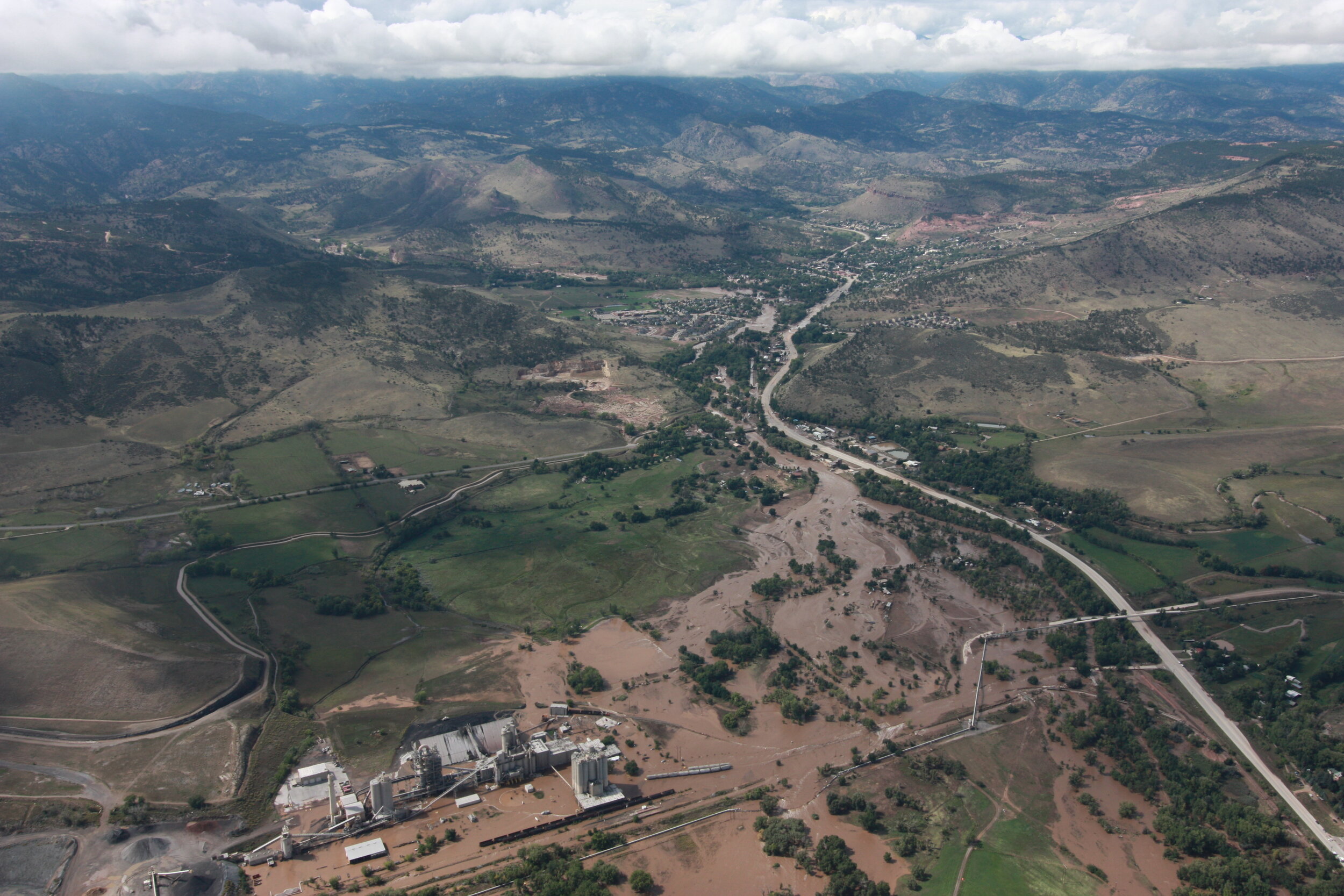
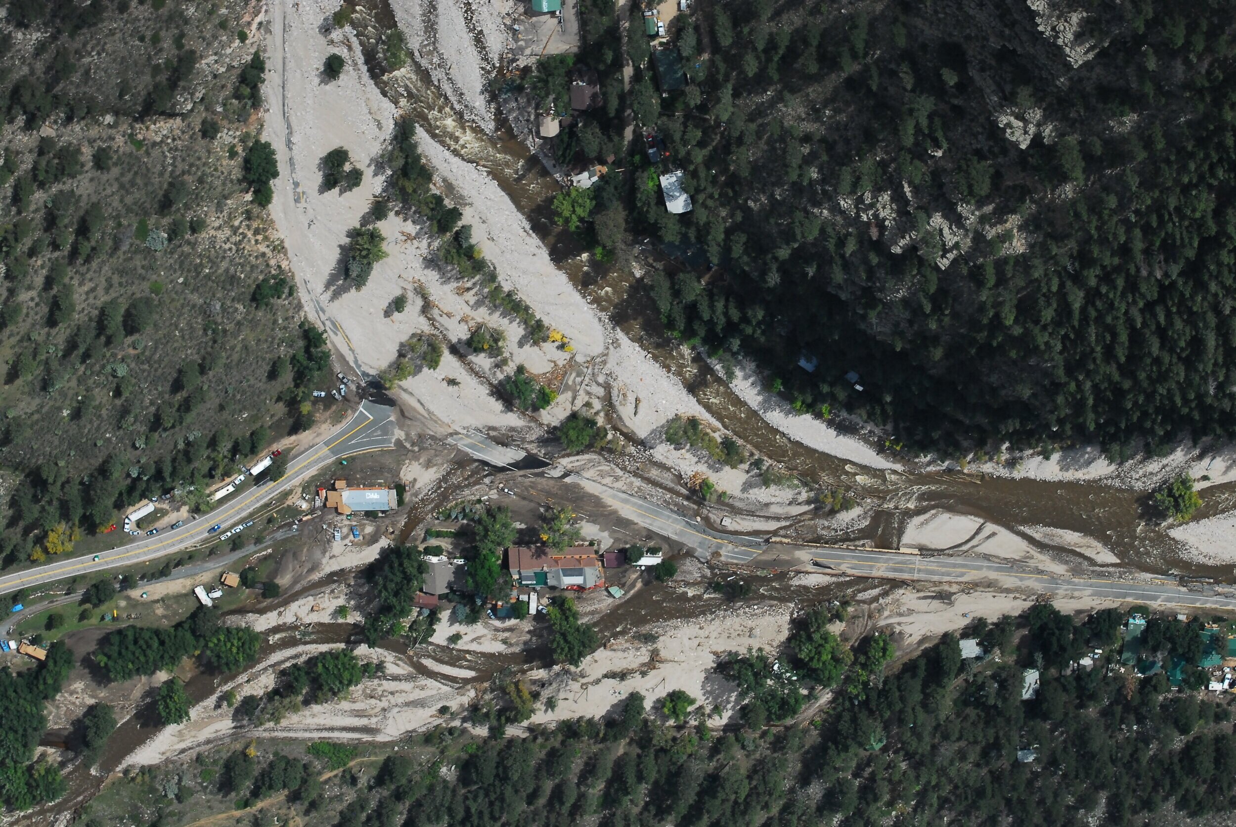
In the aftermath of the devastating floods of 2013, The Colorado Water Conservation Board developed the Colorado Fluvial Hazard Zone Program to help communities better identify, map, and plan for the flood hazards associated with erosion, sediment deposition, and other dynamic river processes. This program is intended to be used both for high flow events resulting from rainfall and snowmelt and also for floods after wildfires.
Short Video Introduction to the Colorado Water Conservation Board’s Fluvial Hazard Zone Program

The Colorado FHZ Program
In order to recognize and assess the hazards associated with erosion, sediment deposition, and other dynamic river processes, the Colorado Water Conservation Board (CWCB) has developed a technical protocol to help communities identify, map, and plan for these natural hazards. The State of Colorado’s Fluvial Hazard Zone Program represents a significant and necessary step forward in adaptively managing stream corridors, preparing for and mitigating flood impacts, and making informed land use decisions based on an awareness of fluvial processes.

The Protocol
The Colorado Water Conservation Board is pleased to announce that the Colorado Fluvial Hazard Zone (FHZ) Delineation Protocol Version 1.0 is posted to the resources page.
For an overview of updates and changes since the draft protocol was released in January 2020 please review the flier below.

Planning and Regulatory Support
CWCB has developed a Quick Start Guide as a starting point to layout the many opportunities and options that communities have to integrate FHZ mapping into their local planning and if desired, regulations. This topic is further discussed on the About page of this website.
CWCB has also produced guidance on Stream Corridor Easements as well as a Model Ordinance for an FHZ Overlay District which are both available on the resources page.
Note: FHZ mapping is not required or mandated by the State of Colorado and participation is voluntary.

Communicating Existing Hazards
Flood-related hazards caused by stream channel movement and the erosion and deposition of sediment within a stream corridor have not traditionally been factored into floodplain management leaving a legacy of costly damage from flooding in Colorado. Since 1978, approximately 50% of all National Flood Insurance Program claims in Colorado have come from properties located outside of regulatory floodplains. Many of these property loss claims are the result of hazards created by fluvial geomorphic processes such as erosion, sediment deposition and channel avulsion.
Fluvial geomorphic processes are natural phenomena within stream corridors and include commonly observed occurrences such as erosion, the transport and deposition of sediment, the recruitment and relocation of wood, and the structural influences of plants and animals. Fluvial geomorphic processes become hazardous when they encounter public infrastructure, houses, businesses, and other investments within and adjacent to the stream corridor.