
Frequently Asked Questions
What is the Fluvial Hazard Zone and why is it important?
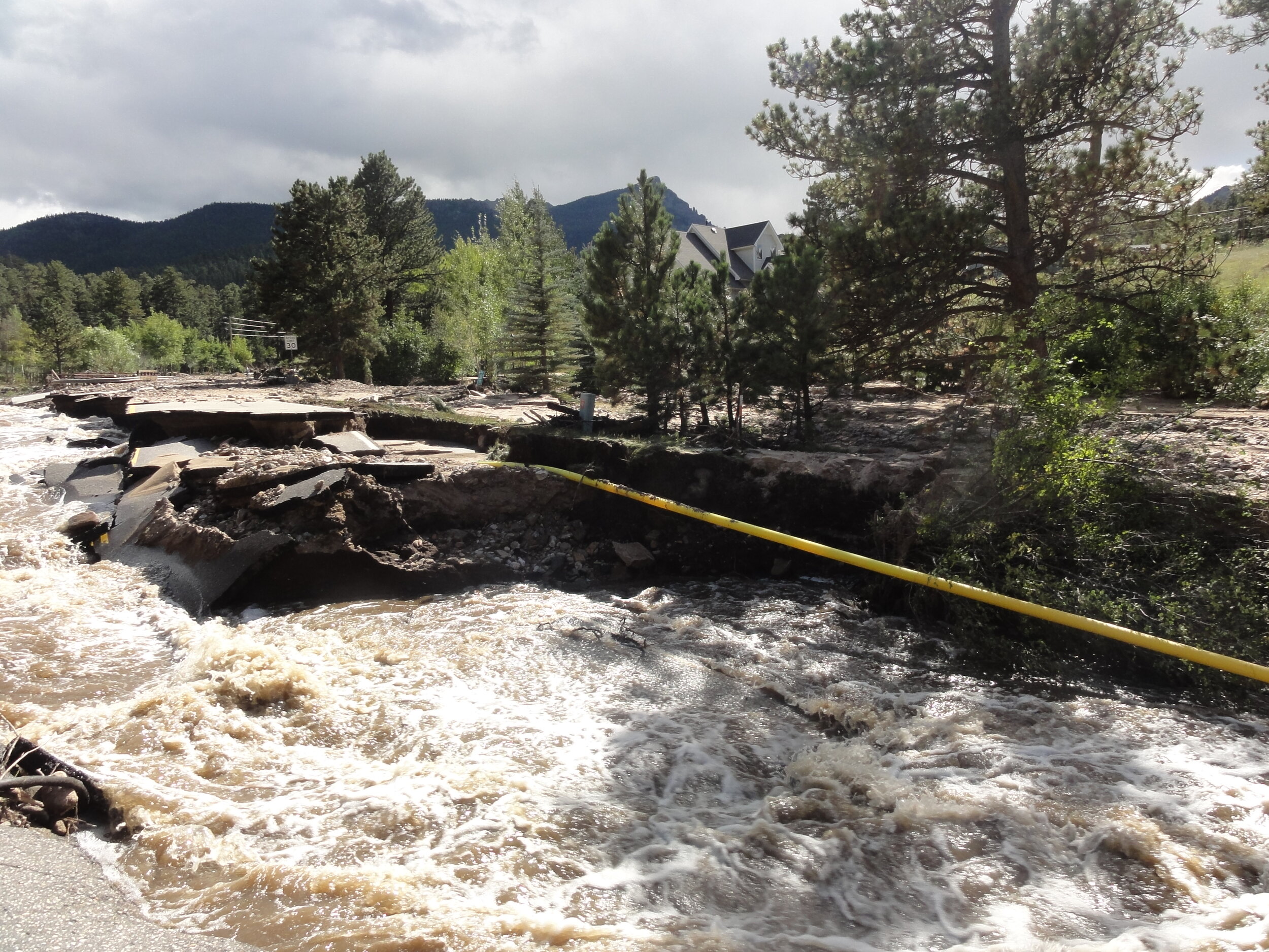
In Colorado, flood hazard identification and mitigation must recognize that streams are naturally dynamic, prone to move within a corridor, and apt to modify their margins as they transport and deposit water, sediment, and debris inputs from their watersheds. Flood insurance claims and property loss data demonstrate that in Colorado, reliance on traditional flood inundation maps alone does not provide a comprehensive characterization of the hazards imposed by fluvial processes. CWCB’s Fluvial Hazard Zone Mapping process considers these dynamic stream processes and represents an important step forward in identifying and communicating these hazards.
The Fluvial Hazard Zone (FHZ) is defined as the area a stream has occupied in recent history, may occupy, or may physically influence as it stores and transports water, sediment, and debris.
The State of Colorado’s Fluvial Hazard Zone Mapping Program represents a significant and necessary step forward in adaptively managing stream corridors, preparing for and mitigating flood impacts, and making informed land use decisions based on an awareness of fluvial processes.
Why map the Fluvial Hazard Zone?
FHZs are mapped to accurately depict flood risk and understanding flood risk is the first step towards reducing flood damages. Accurate hazard maps help residents, businesses, and local governments make informed decisions about personal safety and evacuations, protection of critical infrastructure and financial assets, and plan for emergencies.
FHZ maps provide communities, individual property owners, and emergency response teams with information on flood- and stream-related hazards beyond those identified by traditional floodplain mapping. FHZ maps may be adopted and used for land use regulation at the local level, however, they are not and will not be regulated nor mandated by the State of Colorado. As stream corridors are environmentally and economically important areas, FHZ maps can also aid in prioritizing lands for conservation or maintenance of fluvial hazard compatible land uses, such as agriculture. As Colorado’s FHZ Mapping Program progresses, it is also demonstrating value for post-wildfire flood planning and response.
What are the differences between FHZ Maps and FEMA floodplain maps?
FEMA Special Flood Hazard Areas show where inundation would occur during a flood that has a 1% chance of occurring in any given year (commonly referred to as the 100-year flood or base flood). While this hazard information is very important, the post-flood damage surveys have shown that fluvial erosion and sediment deposition, not inundation, is a prevalent cause of damage to homes and property in Colorado.
FHZ maps also account for sediment and debris that moves through a stream corridor while FEMA floodplain maps only account for the water. FHZ maps account for the fact that rivers change vertically and horizontally over time, and, therefore, are not as likely to become outdated as FEMA maps, which are based on a static representation of the elevation and location of the river at the time when the maps are produced.

Flood Insurance Rate Maps
Map areas of flood water inundation.
Correspond to only one estimated peak flow.
Use a variety of data and methods to map flood surface elevations and extent. This may include historic flood data, rainfall data, topographic data (i.e., LiDAR and field surveys), along with computer models that calculate results for hydraulic equations.
Rules for map development are set by the federal government via FEMA.
Assumes a static stream system with no changes to a stream’s shape throughout the duration of a flood.
Developed with methods that typically do not account for the transport of sediment and debris.
Are typically made by engineers with experience in hydrologic (rainfall and watershed) and hydraulic (stream channel and floodplain) computer modeling.
Created as part of the National Flood Insurance Program (NFIP) and used to determine where flood insurance is required and what rates apply.
Federally and state-regulated product (for community participation in the NFIP).

Fluvial Hazard Zone Maps
Identify where a stream or river may move or may cause damage during a flood (e.g., erode a high bank and undermine a structure or deposit sediment and debris).
Show susceptibility to flood hazards rather than probability.
Use a variety of data and methods including high resolution topographic data (i.e., LiDAR), geologic and soils maps, and field verification.
Assume that river dimensions change during a flood and that flows are transporting sediment and debris.
Rely on fluvial geomorphic (stream form and process) expertise to interpret landforms within the floodplain and along a stream.
Do not affect flood insurance rates, though those with structures within the FHZ are encouraged to purchase flood insurance.
Regulation, if any, is determined by local communities.
Non-federally regulated product.

Comparison of inundation extent and fluvial hazard zone, which, in this example, extends some distance into erodible valley margins. Note that in other systems, inundation extent may extend a greater distance away from the existing stream channel than the fluvial hazard zone.
How are Fluvial Hazard Zones mapped?
FHZs are mapped by fluvial geomorphologists--scientists who study the process of how water shapes the earth and therefore how streams evolve and adjust. Mapping is completed through the interpretation and synthesis of geomorphic, geologic, hydrologic, and biotic information (i.e., data that describes the physical location, form, flooding intensity, active sediment and debris transport, and ecological drivers of a riverine system).
The CWCB has published documents that detail the recommended processes for delineating Fluvial Hazard Zones (2020). Generally, the FHZ is comprised of an Active Stream Corridor (ASC) and a Fluvial Hazard Buffer (FHB). The Active Stream Corridor is where it is possible to see stream bank erosion, sediment deposition, and/or the development of new stream channels in the floodplain. The Fluvial Hazard Buffer encompasses areas on valley margins or terraces where erosion is likely to occur as a result of the stream working against the base of these bounding features. The way the Active Stream Corridor and Fluvial Hazard Buffer are mapped is based on location, valley setting and confinement, slope, geology and stream size.
Where stream corridors enter highly developed areas, floodplain fill, infrastructure, and urban development may influence the fluvial geomorphic hazards and the response of a stream to a flood event. In these cases, the primary fluvial geomorphic hazards come from channel incision, bank failure, and corridor widening, even if a channel is armored, and an Urban Protocol is used to delineate the Active Stream Corridor.
Does mapping the Fluvial Hazard Zone create new hazards in a community?
No. FHZ maps identify and communicate existing hazards that are already present in a community or on a property.
Why is it not called “Erosion Hazard Mapping"?
Erosion is just one of the geomorphic hazards associated with the movement of water and sediment across the earth’s surface as a result of gravity. Simply measuring, modeling, or calculating erosion as bank retreat is insufficient in capturing all fluvial geomorphic hazards in a stream corridor. Other fluvial geomorphic processes at work include deposition of sediment, recruitment and depositing of large wood, channel avulsions (shifting locations that occur as a result of sediment deposition and changing energy grades), fan processes (deposition areas resulting from rapid changes in slope caused by underlying geologic topography or human induced constrictions), channel braiding , and failures of adjacent hillslopes as a result of streams working against erodible valley margins. These processes often result in hazards (i.e., channel movements) that are not explained by simple lateral bank erosion. This program identifies areas susceptible to bank erosion but also includes areas where these other fluvial geomorphic hazards exist.
How are Fluvial Hazard Zones different from buffers/setbacks?
Fluvial Hazard Zone Maps account for all types of fluvial geomorphic hazards in a stream corridor. Stream buffers or stream setbacks, when used as a means to reduce flood damages, assume that streambank erosion is the only hazard in the corridor. While streambank erosion may be the dominant hazard in certain areas, in most locations numerous other fluvial hazards exist including sedimentation and debris deposition, channel avulsions, and the development of flood chutes (as is shown in the image). Buffers assume channel erosion will only progress within a certain distance from the existing channel and this assumption is often a failure to assess and understand the interactions between water, geology, vegetation and human interventions in the stream corridor.
While stream buffers and/or setbacks may be useful for protecting water quality and riparian habitats, establishment and management of Fluvial Hazard Zones will have similar or better environmental and water quality benefits as well as better outcomes for reducing long-term flood risk.

What information does my community need in order to map Fluvial Hazards?
Generally the only data requirement is high-resolution topographic data, such as digital elevation models created from LiDAR or IFSAR, that covers all of the stream corridor and the majority of the stream’s valley. Other data is used for mapping, such as geologic maps and wetland maps, but these are already compiled for the entirety of the State of Colorado. Updated FEMA floodplain maps are not required to complete FHZ mapping.
How much does Fluvial Hazard Zone mapping cost?
The costs for FHZ mapping vary depending on the size of the study area, the objectives of the mapping, and the complexity of the region. For very large study areas with minimal human disturbance and high quality data, the cost could be $500 per mile, or less. For shorter, complex, highly altered corridors the cost could approach $5000 per mile. An example scope of work is included in the Fluvial Hazard Zone Mapping protocol.
Why should communities protect stream corridors?
Stream corridors encompass the area of land surrounding a stream that is necessary to restore or maintain the natural processes, functions, and variety of forms of a channel, floodplain, and riparian plant communities thereby minimizing fluvial hazards over time. Giving streams room to adjust their channel shape and location is critical to avoid adverse impacts to public safety, infrastructure, and stream ecosystems that are so often a result of channel armoring and flood prevention measures.
The naturally stable, least erosive form of a stream is a tremendous community asset. If stream corridors are not protected at the community level, the people of Colorado will bear an ever-increasing burden (i.e., in terms of flood disasters, repair costs and recovery disruptions, and the human misery they cause) when there are less and less places on the landscape where streams can expend the flows and erosive energy of a flood. When we encroach on a stream in one location and then armor the banks to protect our investment, we very often ensure that the next flood of equal flow will cause even more destructive erosion downstream. Breaking the vicious cycle between increasing costs and increasing risk, can be better achieved and is more sustainable where we allow floodplains to flood and streams to meander in those corridors that still remain open. These stream corridors can be thought of as part of our communities infrastructure; when they are degraded communities face significant reduction in the health and function of their natural systems, and when flood disasters occur millions more must be spent to re-channelize and re-fortify with little or no reduction in the vulnerability of the corridor to fluvial processes in the long term.
